Sea level seems like a pretty easy concept, right?
海拔听起来是一个很简单的概念,对吧?
You just measure the average level of the oceans and that's that.
你只用测出海面平均高度就行了。
But what about parts of the earth where there aren't oceans?
但地球上没有海洋的那些部分呢?
For example, when we say that Mt. Everest is 8850m above sea level,
例如,当我们说珠穆朗玛峰海拔8850米时,
how do we know what sea level would be beneath Mt. Everest, since there's no sea for hundreds of kilometers?
我们怎么知道山底海平面的高度呢,因为几千米之内可都没有海水啊。
If the earth were flat then things would be easy -
如果地球是平的,那么事情就容易了——
we'd just draw a straight line through the average height of the oceans and be done with it. But the earth isn't flat.
我们只要在海洋的平均高度上画一条直线就可以了。但是地球并不是平的。
If the earth were spherical, it would be easy, too,
如果地球是球形的,也会很容易,
because we could just measure the average distance from the center of the earth to the surface of the ocean.
因为我们可以测量从地球中心到海洋表面的平均距离。
But the earth isn't spherical - it's spinning, so bits closer to the equator are 'thrown out' by centrifugal effects,
但地球不是球形的—它在自转,靠近赤道的部分因“离心效应”被甩了出去
and the poles get squashed in a bit.
而极点被压扁了。
In fact, the earth is so non-spherical that it's 42km farther across at the equator than from pole to pole.
实际上,地球不是圆形的,所以赤道两端间距离比两极点距离长42公里。
That means if you thought earth were a sphere and defined sea level by standing on the sea ice at the north pole,
这意味着如果你认为地球是球体,并将海平面定义为站在北极海冰上的高度,
then the surface of the ocean at the equator would be 21km above sea level.
那么赤道海平面的高度就成了海拔21千米。
This bulging is also why the Chimborazo volcano in Ecuador, and not Mount Everest,
这也是为什么厄瓜多尔的钦博拉索火山,而不是珠穆朗玛峰,
is the peak that's actually farthest from the center of the earth.
是距离地球球心最远的山峰。
So how do we know what sea level is? Well, water is held on Earth by gravity,
那么我们怎么才能知道海拔高度呢?水因其重力而被保持在地球上,

so we could model the earth as a flattened stretched spinning sphere
所以我们可以把地球建模成一个扁平的拉伸的旋转球体
and then calculate what height the oceans would settle to when pulled by gravity onto the surface of that ellipsoid.
然后计算在重力作用下海水落到这个椭圆球表面的高度。
Except the interior of the earth doesn't have the same density everywhere,
只不过地球内部各处的密度不同,
which means gravity is slightly stronger or weaker at different points around the globe,
这意味着地球上不同地点的重力有小幅波动,
and the oceans tend 'puddle' more nearer to the dense spots.
并且海洋在密集处聚集的更多
These aren't small changes, either - the level of the sea can vary by up to 100m from a uniform ellipsoid
这些并不是小变化——海水高度与椭球面最多相差可达100米,
depending on the density of the Earth beneath it. And on top of that, literally,
这取决于其下方的密度。而它的上面,
there are those pesky things called continents moving around on the Earth's surface.
是那些在地球表面到处晃悠的讨厌东西。
These dense lumps of rock bump out from the ellipsoid and their mass gravitationally attracts oceans,
这些稠密的岩石块从椭球体中碰撞出来,它们的质量在引力作用下吸引着海洋,
while valleys in the ocean floor have less mass and the oceans flow away, shallower.
而海床上的峡谷质量较小,上方的海水也因此流走
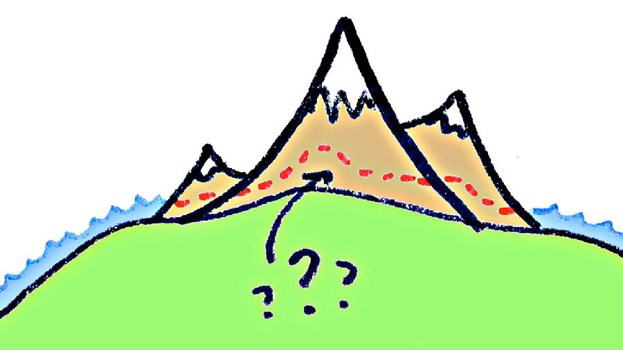
And this is the real conundrum, because the very presence of a mountain (continent on which it sits) changes the level of the sea:
这才是真正的难题,因为一座山(它所在的大陆)的存在改变了海平面:
the gravitational attraction of land pulls more water nearby, raising the sea around it.
陆地上的万有引力吸引附近更多的水,使周围海面更高。
So, to determine the height of a mountain above sea level,
所以为了确定一座山的海拔高度,
should we use the height the sea would be if the mountain weren't there at all?
我们是否该用假定山不存在时的海面高度呢?
Or the height the sea would be if the mountain weren't there but its gravity were?
或者仅保留山的重力时海平面高度?
The people who worry about such things, called geodetic scientists or geodesists,
那些担心这些事情的人,被称为大地测量学家或测地学家,
decided that we should indeed define sea level using the strength of gravity,
他们认为在测量海平面时应该考虑到重力因素,
so they went about creating an incredibly detailed model of the earth's gravitational field, called, creatively, the Earth Gravitational Model.
于是他们开始着手创建一个非常详细的地球重力场模型,这个模型很有创意,叫做地球引力模型。
It's incorporated into modern GPS receivers so they won't tell you you're 100m below sea level
这个模型被植入了现代GPS接收器,所以当你坐在斯里兰卡的海滩上时
when you're in fact sitting on the beach in Sri Lanka which has weak gravity,
它不会说 你当前在海拔-100米,那里重力略低,
and has allowed geodesists themselves to correctly predict the average level of the ocean to within a meter everywhere on Earth.
重力场图让测量者能够正确地使全球海平面的高度在上下一米之内浮动。
Which is why we also use it to define what sea level would be underneath mountains if they weren't there... but their gravity were.
这也是为何我们用它来测量山底下海平面的高度视其身不在,而重力在。


